
Cumberland County Past Residents by Era
The backward trail has several layers, and each answers a different question. The tax listing gives a current starting point. A recorded deed connects parties and legal land language. Historic city directories and street guides add household clues. Maps, newspapers, and census material test whether a building and neighborhood fit the period. A result from any one layer is useful, but past residents are best identified when the address, time, and source agree.
| Source | Time coverage | Where held | What it can show |
|---|---|---|---|
| Register of Deeds land index | Office says online search reaches to 1754; confirm the series | CCROD Internet Search, counter, or mail copies | Recorded parties, instrument type, dates, and legal-description clues |
| Tax Administration | Current-year parcel data online; older value and billing research uses an abstract route | Tax search and Tax Administration | Listing name, situs, REID, PIN, and current parcel context |
| Fayetteville directories | Cataloged examples from 1909-1910 through 1960, with local runs listed into the 1980s | Headquarters Library and DigitalNC | Householders, streets, neighborhoods, and telephone clues |
| Sanborn maps | Cited Fayetteville sheets include 1885, 1891, 1896, 1901, 1908, 1914, 1923, and 1930 | Library of Congress and local history sources | Building footprint, use, material, block number, and street context |
| Census and newspaper material | Date-specific access and lookup rules | Library collections, microfilm, and archival research | Household and neighborhood context, subject to the source’s access rules |
Begin with a current parcel when the address is known. Begin with the closest directory or map when the question is older than the current building record. The Headquarters Library local-history collection has city directories, maps, newspapers, census materials, photographs, and focused staff help. Its staff can retrieve books or microfilm, but it does not perform extensive family research, so a narrow street, surname, and date range are important.
Cumberland County Starts With Today’s Parcel
For an address still standing, start with Cumberland Tax Administration Real Estate Search. Its address mode uses the physical street and separates it from the owner or business-name search. Enter the street number when known, and enter the street name without the street type or direction word, as the portal instructs. Save the listing name, situs address, REID, PIN, tax year, and any mailing-address distinction that appears.
A situs address is the physical location assigned to the parcel. A mailing address is where notices go. They can differ, so neither field alone identifies who lived at the property in an earlier year. The county states that its online site shows current-year parcel information. Prior-year value and billing research uses a bill number, parcel number, owner, or street clue followed by the abstract route. That split is why a present card should be treated as a starting marker, not a complete house history.
The county’s real-estate and GIS mapping page also connects parcel research to the GIS layer. Use GIS to see the parcel relationship and the deed index to test an older ownership link.
Note: Preserve the REID, PIN, situs, mailing distinction, and tax year together so a later deed search stays tied to the same parcel.
Cumberland County Past Residents Through Deeds
The Register of Deeds is the legal-instrument layer for a backward address trail. Its Internet Search is described by the office as reaching back to 1754, though a searcher should still check the relevant instrument series and image availability. The index is a finding aid. The deed or other recorded image is the document that supplies the legal description and the names needed for the next link.
- Use the tax result to record the current listing name, REID or PIN, situs address, and any parcel or subdivision clue.
- Search the current name in the Register of Deeds grantor and grantee index, then open the likely deed or deed-of-trust image.
- Read the legal description and identify the earlier grantor. Search that person as a grantee to locate the prior acquisition.
- Repeat the sequence backward, comparing recording date, lot or plat reference, and legal description at every change.
- Use the Register of Deeds counter or mail-copy route when a scanned book, older index, or certified copy is needed.
- Grantor and grantee
- The grantor transfers an interest in the recorded instrument. The grantee receives it. Their roles can reverse when the next deed is found.
- Chain of title
- A sequence of recorded instruments that links one ownership interest to an earlier one. Estates, trustee deeds, quitclaims, boundaries, and name changes can interrupt a simple line.
- Legal description
- The recorded land description, often using lot, plat, boundary, or subdivision language. It can remain steadier than an old street number.
- Index and image
- An index points to a record. An image is the scanned recorded document. A certified copy is issued by the office and is not the same as a downloaded PDF.
The Register of Deeds does not perform title searches because it cannot provide that legal service. Its FAQ lists copy routes and fees, including $0.25 per page for an uncertified copy, $5 for the first certified page, and $2 for each additional certified page.
Cumberland County Address Numbers in 1951
Fayetteville’s citywide street renumbering and street-renaming effort in 1951 is a key break in an address history. A number in a 1924 directory may not be the number shown on a modern parcel, even when the building or family connection is real. Treat the mismatch as a research question. Compare the older street guide, a Sanborn sheet, the deed’s legal description, and intersecting streets before deciding that a household moved.
The problem has a recent echo. Plantation Avenue became Garden Avenue and Chattel Street became Reflection Street, effective in January 2026. Search both names for a recent previous-residents trail, attach the date to each version, and confirm the current official label with city or county records. That preserves old evidence instead of silently replacing it with a new name.
Cumberland County Past Residents in Directories
Ownership is only one part of an address history. A street guide can place householders or concerns opposite a number, even where a deed points to an owner who lived elsewhere. The 1915-1916 Fayetteville volume contains alphabetical, business, street, and miscellaneous sections. The 1959 volume includes an alphabetical residents section, a householder and street guide, and a numerical telephone section. These volumes make it possible to test who lived here before without treating a current tax listing as a household record.
The 1909-1910 Fayetteville directory catalog record is one online starting point for the historical sequence.
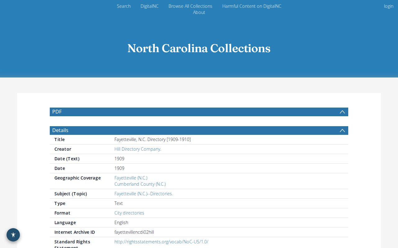
Catalog records and scanned volumes provide a dated street or name layer that can be compared with the parcel and deed trail.
- Choose the directory closest to the address date and search both the alphabetical list and street guide.
- Write down the printed street number, cross street, householder or concern, neighborhood, and any phone or occupancy notation.
- Move one directory at a time and treat a changed number as a possible renumbering, not immediate proof of a move.
- Compare the directory date with census neighbors, maps, newspapers, and recorded deeds. The state genealogy guide recommends retaining nearby households when a neighborhood comparison is needed.
- Use the proper custodian to confirm an important life event, estate record, or recorded land transfer.
The 1937 Fayetteville directory catalog record provides another dated point in the local sequence.
Using a second directory year helps test whether a name, address, or neighborhood clue persisted before the next deed or census comparison.
The collections themselves are described more fully in the Cumberland County city directory. For a targeted newspaper or obituary question, the library asks for a date of death or another narrow date clue because its newspapers are not indexed by name alone.
Cumberland County Maps and Old Addresses
Sanborn maps add a physical check to a name-and-address trail. Fayetteville material includes cited sheets from 1885, 1891, 1896, 1901, 1908, 1914, 1923, and 1930. A sheet can show a building’s size, shape, construction material, use, street width, boundaries, water mains, hydrants, and house or block numbers. It can show whether an address was a residence, store, church, school, or vacant lot at the time.
The Library of Congress 1891 Fayetteville Sanborn record is a useful example of the map evidence available online. A map does not identify every resident, but it can test whether the historic number and structure make sense beside a directory entry or legal description.
Note: Use a Sanborn sheet as period evidence for a structure and block, then pair it with a dated directory or deed for names.
Cumberland County Estates and Earlier Households
A deed chain often reaches an estate, trustee deed, quitclaim, boundary agreement, satisfaction, or name change rather than a clean sale. The Cumberland County Clerk of Superior Court holds estate and special-proceeding material, while the Register of Deeds keeps recorded instruments. An estate reference may explain a transfer, but it does not prove that every heir lived at the address. Compare the case, deed, legal description, and date before treating a surname as part of the household history.
For older research, the library and State Archives Cumberland records are the fallback when a modern index does not carry the needed layer. The library’s resource guides include local newspapers, America’s News, Ancestry Library Edition, and digital newspaper resources. Some are licensed research tools rather than county public records. Focused staff help works best with a street, surname, and narrow time range.
Cumberland County Records After 1831
Fayetteville’s 1831 fire burned much of the city, so the survival of early evidence is a record-specific question. A missing volume or online hit does not establish that a household was absent. Cumberland itself was formed in 1754, and early material may use Choeffington, Cross Creek, Campbellton, Fayetteville, or a rural place description for related geography. Search the older place name and read the land description when a modern city label fails.
The county history and local record timeline make the gap visible without filling it with assumptions. For pre-digital or pre-statewide material, move to older indexes, microfilm, newspaper issues, archive collections, or office-held volumes. Record the source checked and the date range that remains unknown. That makes a past-residents conclusion more useful than a long list of untested same-name results.
Respect Past Cumberland County Residents
House history, family history, estate questions, and civic research can require a backward address trail. Keep the work tied to the record needed, avoid republishing a private address, and do not use a same-name result to follow, contact repeatedly, threaten, or harass anyone. A protected or missing address can be a safety measure rather than a gap to reconstruct.
A reliable Cumberland County previous residents search distinguishes the record’s purpose from any inference drawn from it.